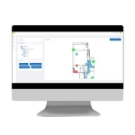
The Extronics Location Engine (ELE) software utilises hybrid location technology to provide “dot on a map” for visualisation platforms, reducing infrastructure requirements.
When used with iTAG X-Range of worker safety tags, Extronics’ Location Engine (ELE) determines the tag location using a proprietary algorithm which includes GPS, RSSI trilateration (Wi-Fi sniffing and BLE), and LF location data. The ELE can gather this tag data from various connectivity technologies such as Wi-Fi, LoRa or Cellular (Hardware dependant) to suit the clients infrastructure requirements.
The ELE uses its advanced decision making algorithm to accurately locate workers or assets anywhere on site. Using Hybrid technology, the ELE increases the accuracy of location data. For example, indoor spaces, such as processing areas with high metallic structures, can be configured as hybrid zones to prioritise the use of Wi-Fi and BLE data, over GPS data. Battery powered BLE beacons can be easily added to a site to enhance the positional accuracy without installing cabling to more APs/Gateways.
In outdoor environments, such as tank farms or storage yards, the use of GPS technology would be more appropriate meaning fewer Wi- Fi APs or LoRaWAN gateways are required as they are only used for connectivity.
How to get the location data out of the ELE is just as flexible as how it is generated. The ELE has a comprehensive REST API and websockets available for seamless integration into 3rd party systems. This could be visualisation software showing worker location during an emergency, or it could be a business intelligence package used for analytics to help drive operational efficiency. How you use your data is up to you.
In a large facility with hundreds of BLE beacons used for trilateration, it can be time consuming to position and configure these on the site maps. The ELE site manager app is built to make deployment of location hardware in the ELE as easy as possible. Maps are downloaded to the app, running on a tablet, and give the user the ability to add BLE beacons to the map while out in the field. Placing the BLE beacons on the map is quick and intuitive. Using the tablets’ camera to scan the QR code on the iTAG XB40 beacons means human error is eliminated when inputting MAC addresses. Once the BLE beacons have been installed and positioned in the site manager app, data can be synced back to the ELE with the click of a button.
–
–
–