 Ducks Unlimited focuses on the conservation, restoration, and management of North America’s wetlands and associated habitats for waterfowl. Their efforts benefit other wildlife, people, and the environment. They partner with government, industry, non-profit organizations, and landowners to connect people to nature and make a healthier world for future generations. In 2017, they began a two-year study for Ducks Unlimited Canada, (DUC) the largest they’ve seen to date*. The study covers included 76 million acres of the Borel Forest in the Northwest Territories’ wilderness.
The result? A highly detailed map outlining existing habitats and plants that make up those habitats. Ducks Unlimited’s partners will use the data to inform their land claim and development plans. The communities located in the area will also be able to use the information collected, and it will provide a baseline for future comparisons in studying the impacts of climate change.
MobileDemand Solution
Ducks Unlimited needed an ultra-rugged tablet, and ultimately decided on the xTablet T8650 from MobileDemand. The T8650 features that grabbed the attention of Michael Merchant, one of the project leaders, were the IP65 rating, a hot-swappable battery, barrel-jack charging port, a 3-year xProtect warranty, and the available accessories.
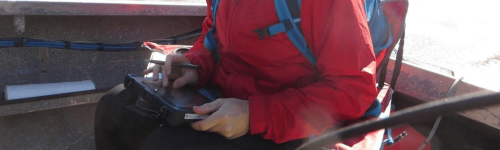
The MobileDemand T8650 rugged xTablets were acquired by the DUC field team to support in-field navigation and spatial data recording purposes. ArcGIS, a spatial mapping software, was loaded onto the tablets prior to the field campaign. The software allowed the analysts to view satellite imagery in the field in relation to their GPS spatial location. Furthermore, this supported navigation from site-to-site, and was a welcome time-reduction in comparison to paper-map navigation techniques. Lastly, the tablets allowed analysts to record a GPS point each time a site was surveyed, making the recording process seamless and quicker.

*For more information regarding the study, read the article provided by CBC News.